Land Use Planning is a critical instrument in realizing the Sustainable Development Goals (SDGs), a set of 17 global objectives established by the United Nations in 2015. These goals aim to eradicate poverty, protect the environment, and ensure prosperity for all by 2030. Land Use Planning involves the careful evaluation of land and water potential, examination of different land use options, and consideration of economic and social factors to determine the most beneficial use of land. This practice plays a pivotal role in achieving several of the SDGs, as land is a vital resource for many of these objectives.
For instance, Land Use Planning can significantly contribute to Goal 2 (Zero Hunger) by promoting sustainable agricultural practices. This ensures that farmlands are used efficiently and responsibly, leading to sustainable food production systems and improved nutrition. It can also support Goal 11 (Sustainable Cities and Communities) by guiding urban development. This involves planning for less urban sprawl and more compact, dense cities, which helps reduce land consumption, enhances the efficiency of infrastructure, and fosters sustainable urbanization.
Moreover, Goal 15 (Life on Land) is closely linked with Land Use Planning. By setting aside protected areas and regulating land uses that could negatively affect biodiversity, planners can help conserve and sustainably use terrestrial ecosystems. This is crucial for preserving biodiversity, reducing land degradation, and halting biodiversity loss.
Another significant intersection is with SDG 13 (Climate Action). Land Use Planning decisions have a profound impact on greenhouse gas emissions. By influencing the balance between carbon sinks and sources and affecting transportation-related emissions, thoughtful land use can contribute to climate change mitigation. It also plays a role in adaptation strategies, as well-planned land uses can reduce vulnerability to climate-related hazards.
The essence of sustainable land management within the SDG framework is to balance various land uses with the land's capacity to provide goods and services without diminishing its quality, productivity, or function. When Land Use Planning incorporates the principles and objectives of the SDGs, it becomes a powerful mechanism to achieve sustainability across different scales, from local communities to the global stage.
Integrating SDGs into Land Use Planning frameworks requires a holistic approach. This involves considering environmental, social, and economic dimensions simultaneously. For example, land use decisions should aim to maximize economic benefits while ensuring social equity and minimizing environmental impacts. This multifaceted approach is essential to meet the diverse needs of present and future generations.
Moreover, effective Land Use Planning requires the participation of various stakeholders, including governments, local communities, the private sector, and civil society. This inclusive approach ensures that the planning process reflects the needs and aspirations of all segments of society. It also fosters a sense of ownership and responsibility towards the implemented land use policies.
Land Use Planning is not just a tool for spatial organization but a strategic approach to achieving sustainable development. By aligning land use decisions with the SDGs, planners can ensure that land resources are used efficiently and responsibly, contributing to a sustainable future for all. This alignment underscores the interconnectedness of environmental stewardship, economic development, and social equity, which are fundamental to the SDGs. The challenge, therefore, lies in crafting and implementing land use policies that effectively integrate these diverse but interconnected objectives.
Ethiopia has experienced rapid urbanization over the past three decades. Several cities expanded rapidly and many satellite towns sprung up around the major cities. The high rate of urbanization and urban growth resulted in high demand for urban land, mainly for industrial, commercial, and residential purposes. In order to meet the demand, an enormous amount of land has been made available for urban use, mainly through land conversion. However, we know very little about how efficiently cities use urban land.
Tracking progress toward the Sustainable Development Goals (SDGs) requires monitoring of various social-ecological indicators over space and time, including the ratio of land consumption rate to population growth rate (LCRPGR), an indicator of land-use efficiency (SDG 11.3.1). In this study, we analyzed state-of-the-art Earth observation data (1975–2015) to address three key questions. First, how has the LCRPGR varied over space and time? Second, how is built-up expansion related to population increase across regions?
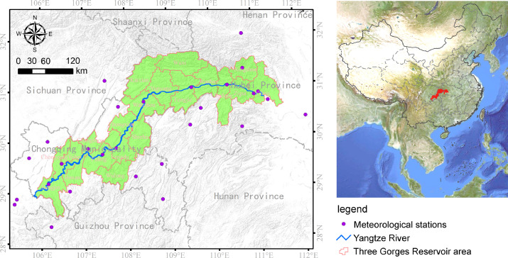
Climate, land use and land cover (LULC) changes are among the primary driving forces of soil loss. Decoupling their effects can help in understanding the magnitude and trend of soil loss in response to human activities and ecosystem management. Here, the RUSLE model was applied to estimate the spatial-temporal variations of soil loss rate in the Three Gorges Reservoir (TGR) area during 2001–2015, followed by a scenario design to decouple the effects of climate and LULC changes. The results showed that increasing rainfall generated as much as 2.90 × 10⁷ t soil loss in the TGR area.

